David McKenzie
Level Designer — Wargaming Seattle
Competitive multiplayer map production for a 3D vehicle-combat title (custom engine). Shipped terrain heightmaps and authored maps designed for large-team vehicle combat.
Wargaming — Competitive Multiplayer Maps
From 2014 to 2017, I worked as a Level Designer with Wargaming Seattle on a 3D vehicle-combat title built in a custom engine. My core responsibilities included building, playtesting, and shipping competitive multiplayer maps from layout to final art, alongside environmental systems support, interdisciplinary liaising, and gameplay ideation.
Responsibilities
- Built, iterated, and shipped competitive multiplayer maps from concept through final art pass.
- Owned combat space readability: lanes, sightlines, cover distribution, traversal constraints, and objective pressure.
- Collaborated across design, art, engineering, and production to keep maps performant, legible, and fun under real match conditions.
- Prototyped and pitched new environmental mechanics and hazards when they improved strategic depth and moment-to-moment decisions.
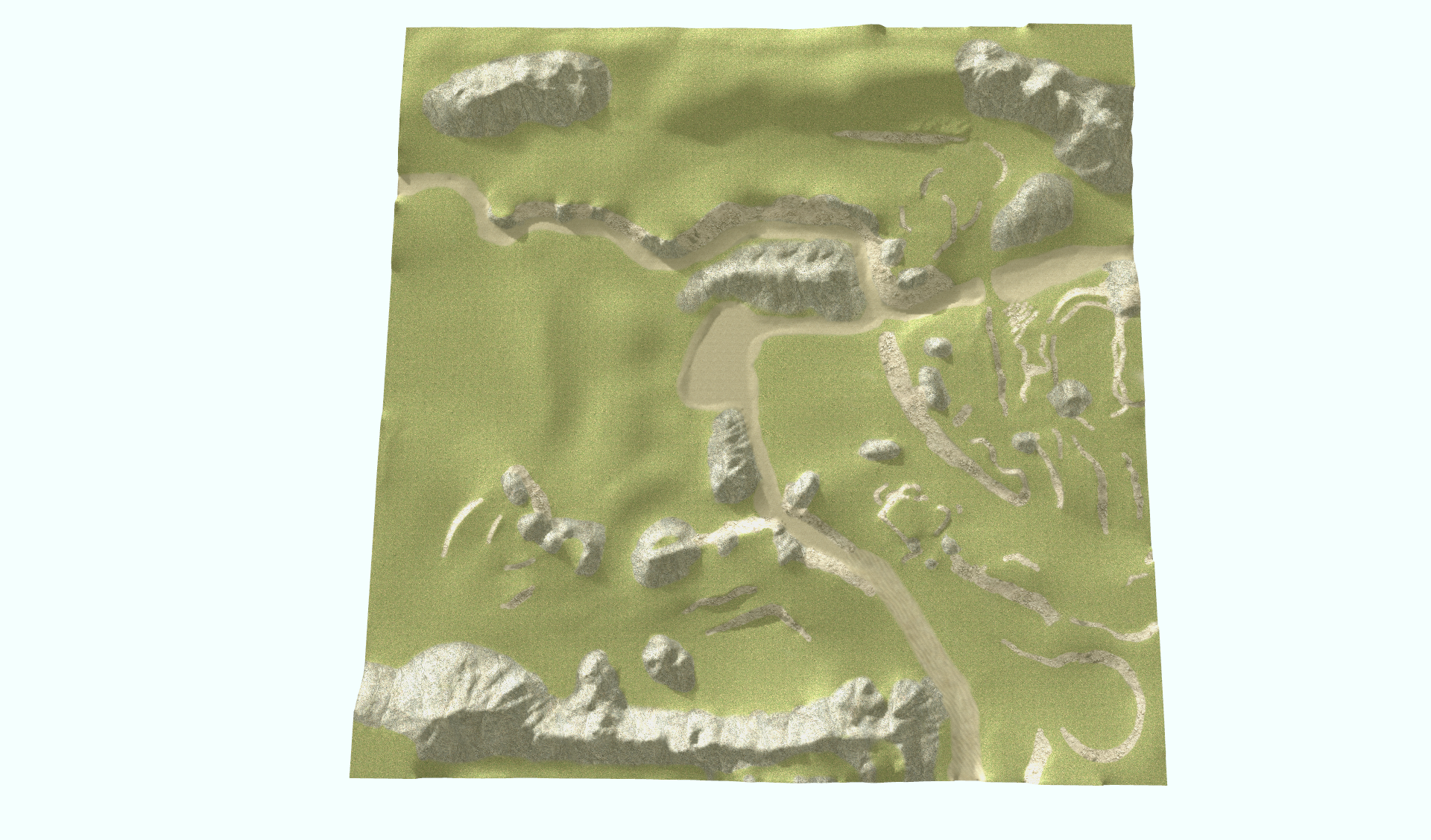
Terrain Heightmaps — Prototype to Ship
I prototyped and shipped terrain heightmaps for a 15v15 vehicle battle simulator, using terrain form to control engagement distances, define safe rotations, create meaningful high/low ground tradeoffs, and support multiple vehicle archetypes. This work included fast iteration on terrain silhouettes, validation in playtests, and refinements for collision/feel, line-of-fire clarity, and performance constraints.
- Terrain as macro-design: shaping engagement ranges and positional advantage without relying on heavy signage.
- Cover as a system: predictable, learnable, and evenly distributed across lanes and roles.
- Iterative tuning: playtest-driven adjustments to peaks/valleys, ditches/berms, and rotation pathways.
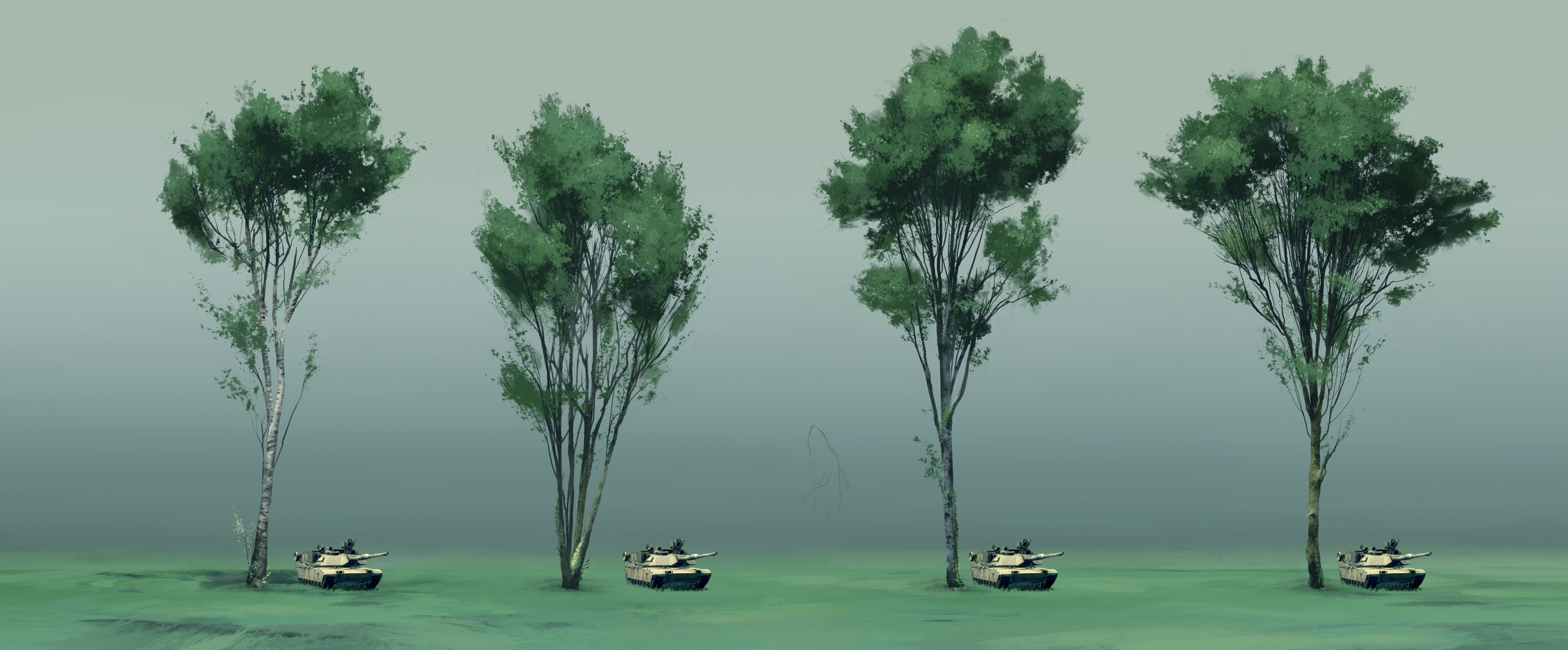
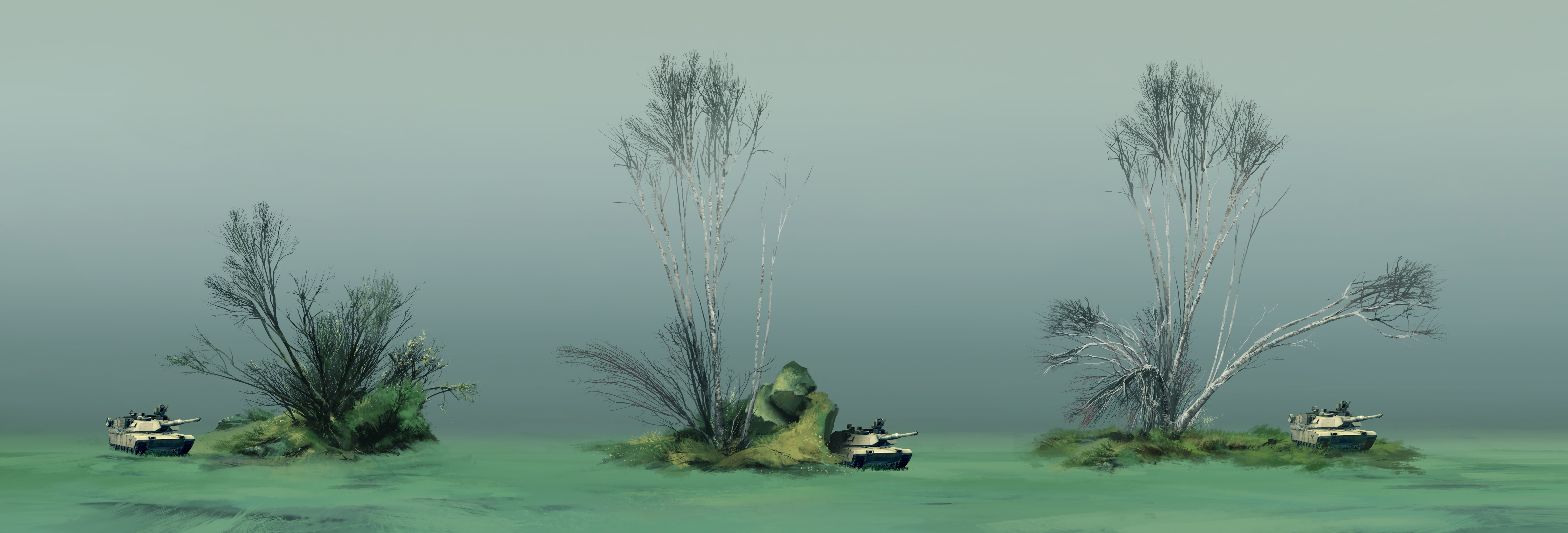
Physically Simulated Trees — Havok Constraints & Real-World Validation
I supported a core pillar of the game’s identity by developing and tuning physically simulated trees across the entire project. I authored documentation for consistent authoring and debug practices, then carefully tuned Havok system constraints using wood density data for different tree species gathered from real-world forestry studies. To validate the resulting feel and break behavior, I compared in-game outcomes against reference footage of real tanks crushing trees.
- Built documentation and guidelines so designers and artists could author forests consistently and predictably.
- Calibrated Havok constraints using species-specific wood density as a grounding metric for strength and failure behavior.
- Validated simulation results against real-world reference footage to hit a believable “vehicle vs. environment” signature.
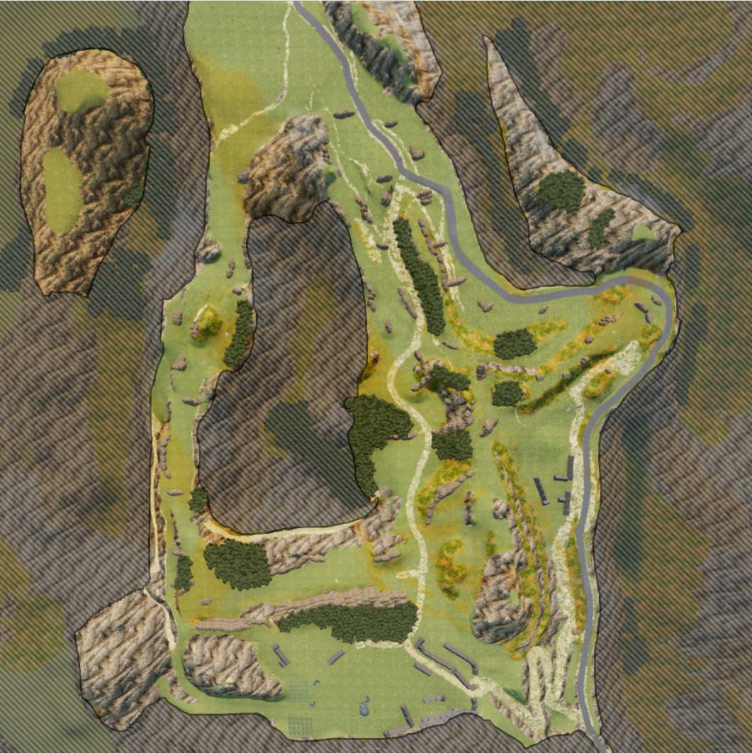
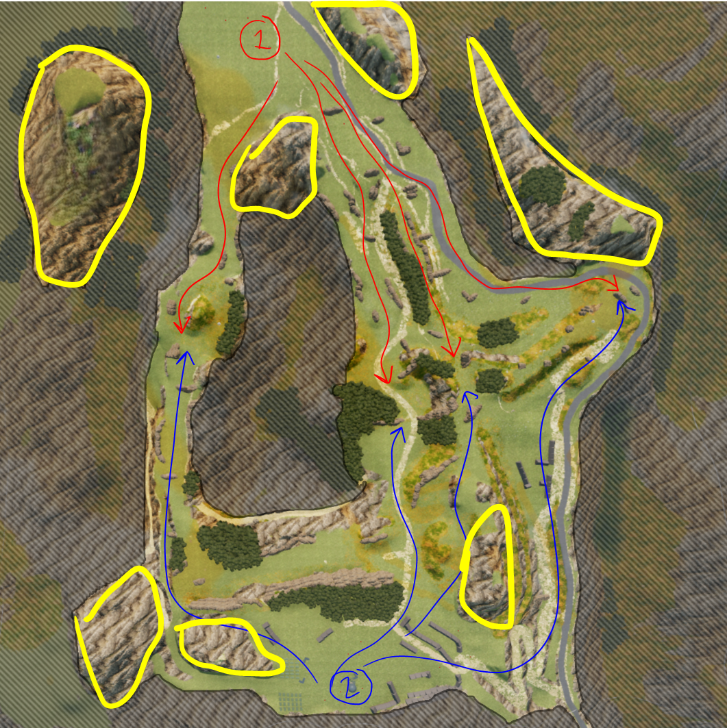
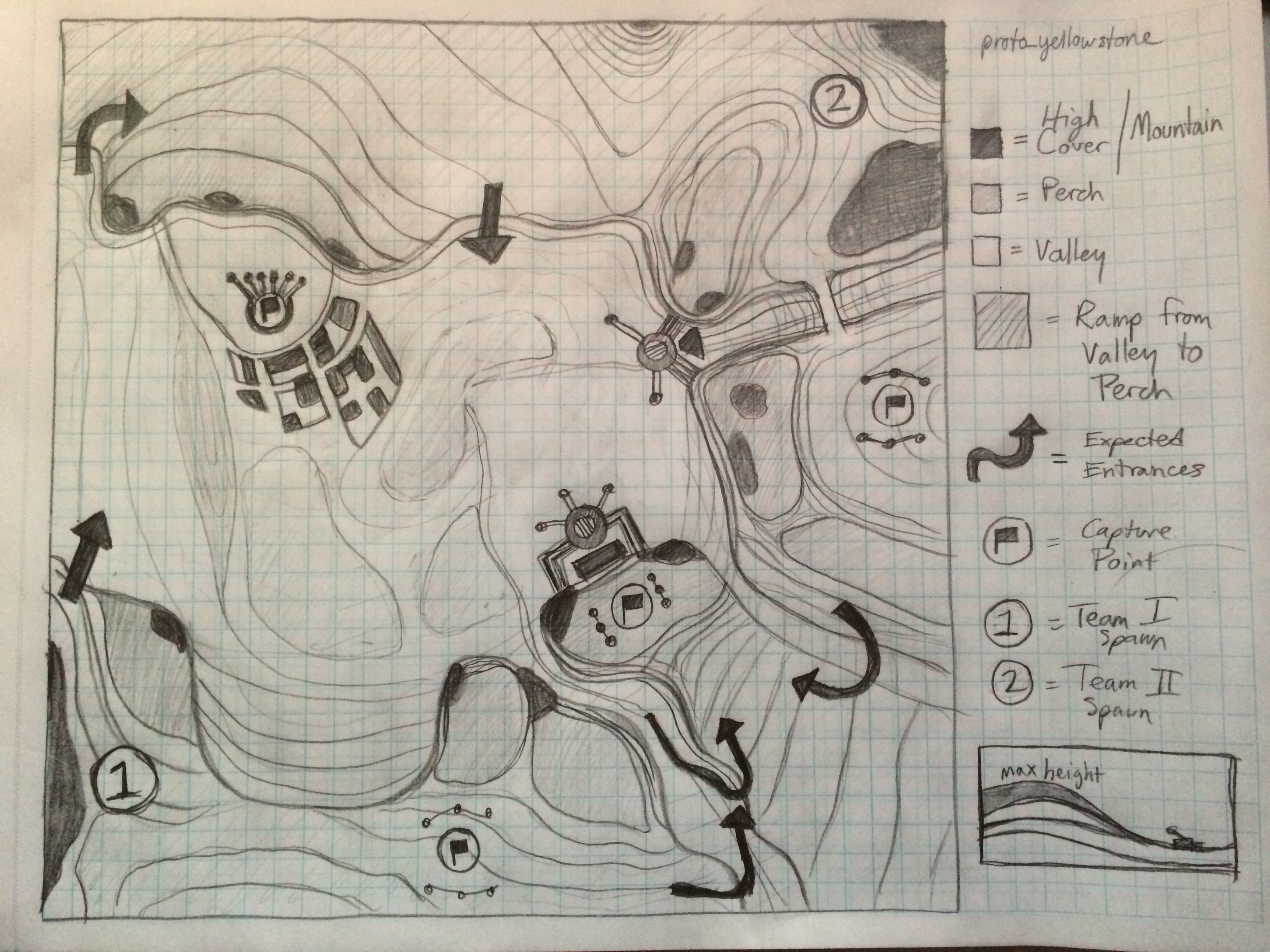
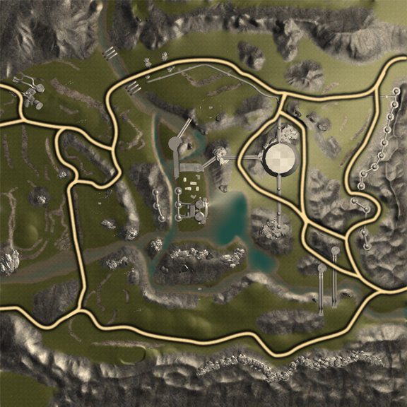
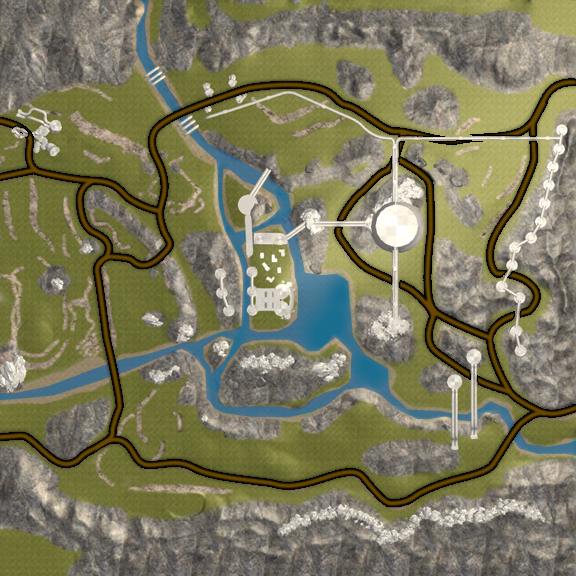
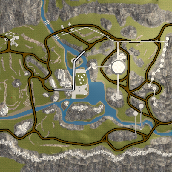
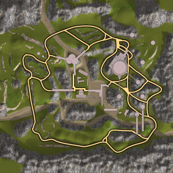
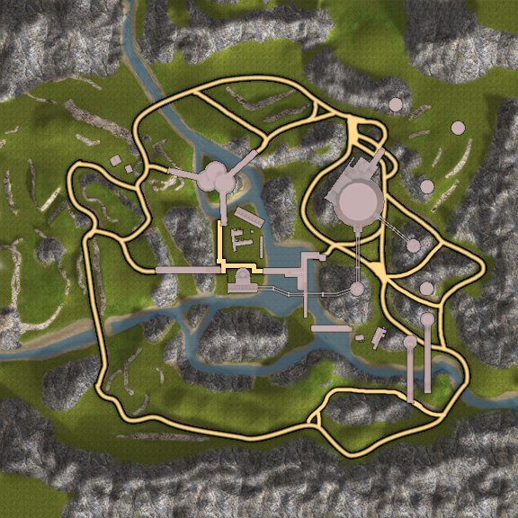
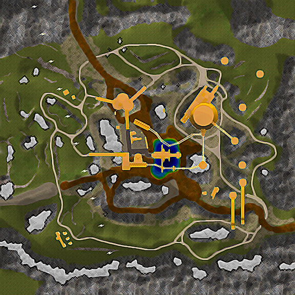
Selected Maps
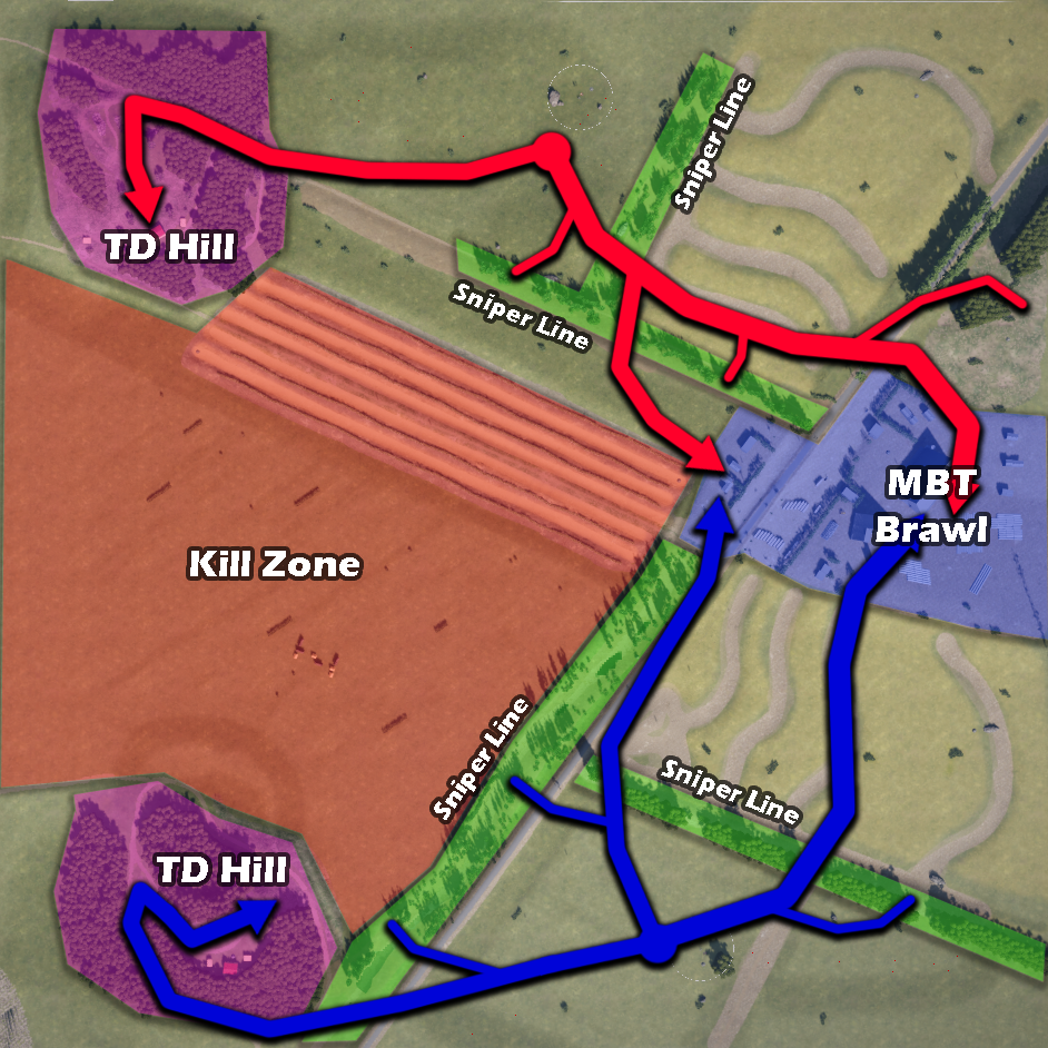
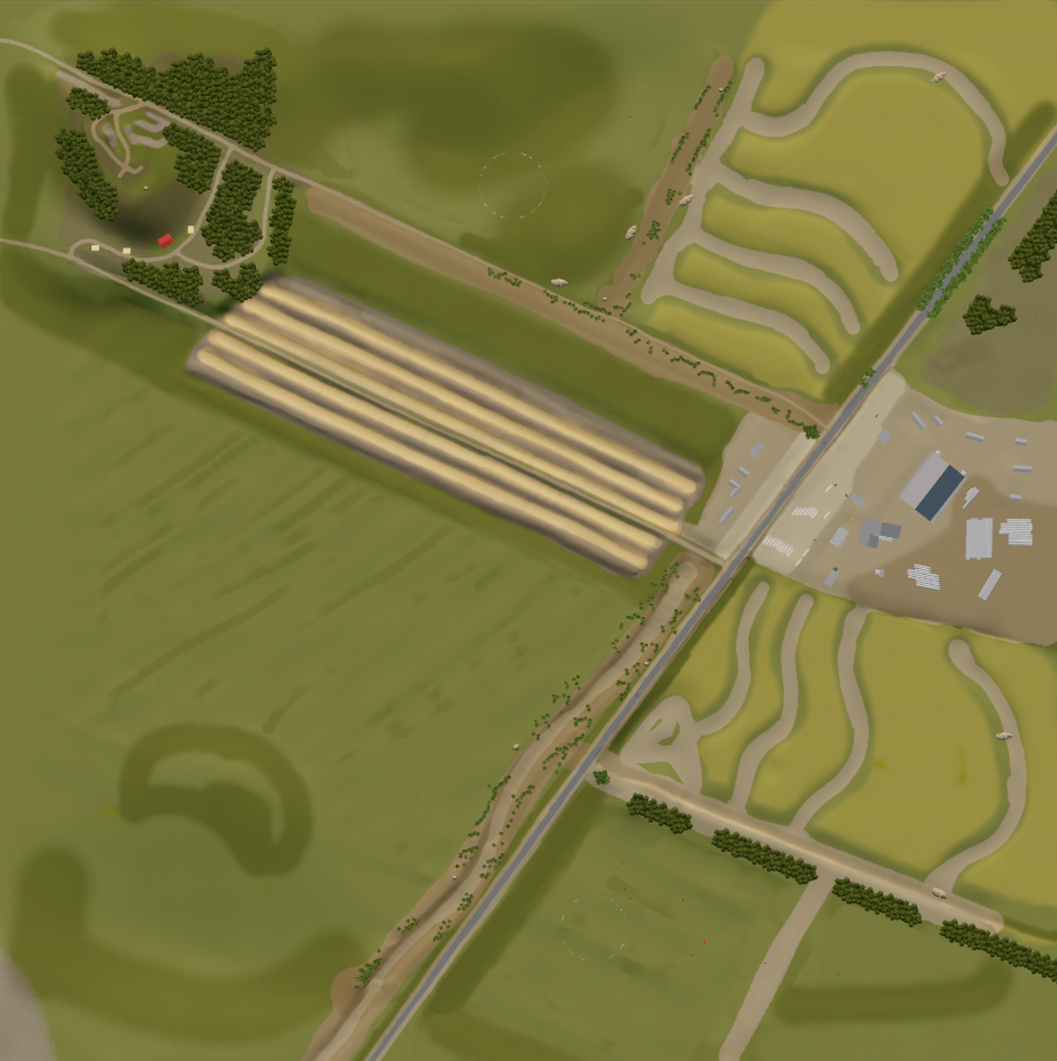
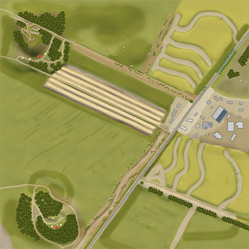
Four maps authored at Wargaming, showing topdown and iteration artifacts (concepts → topdowns → whitebox → minimap → final → progress), plus targeted feature callouts where relevant.
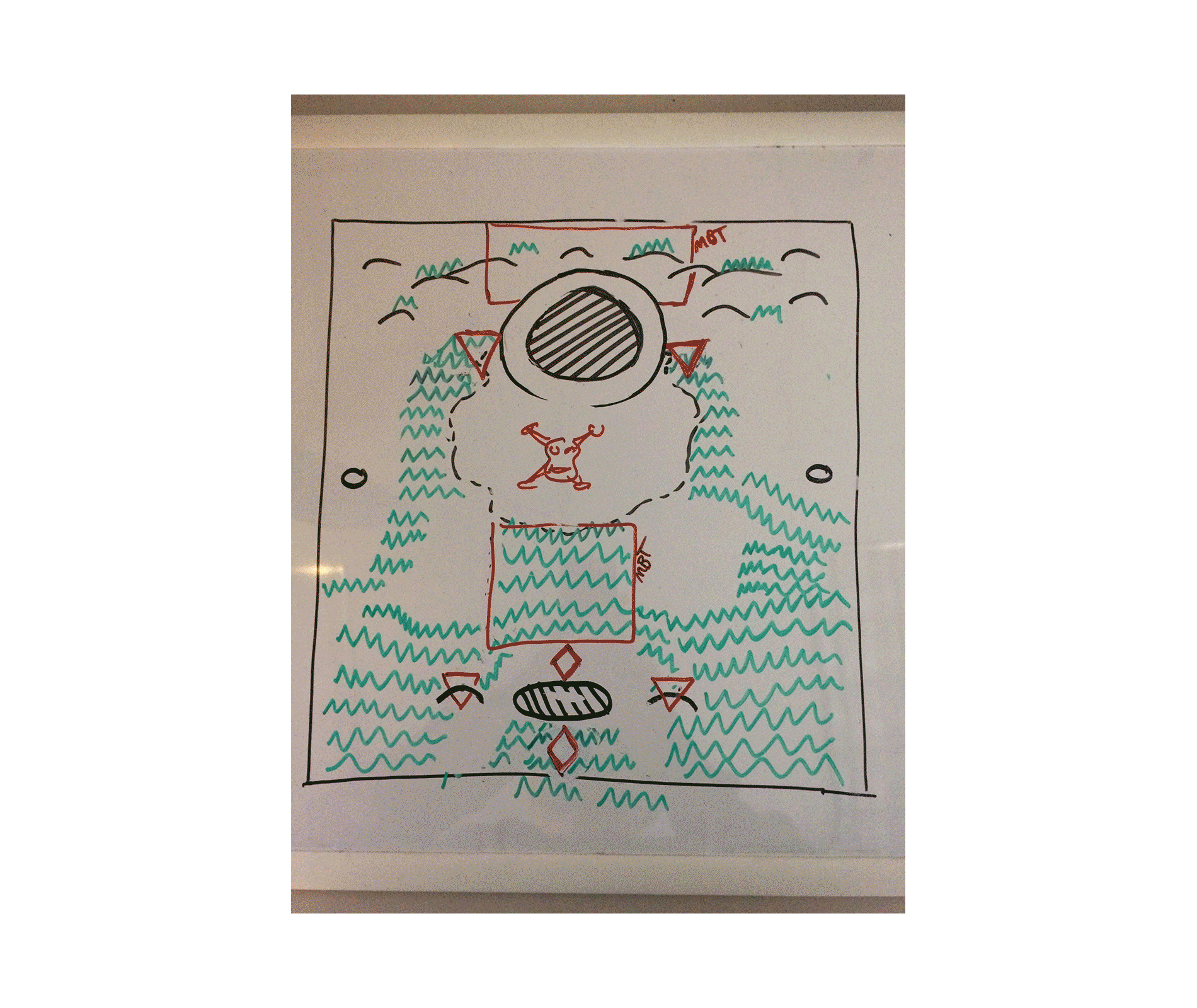
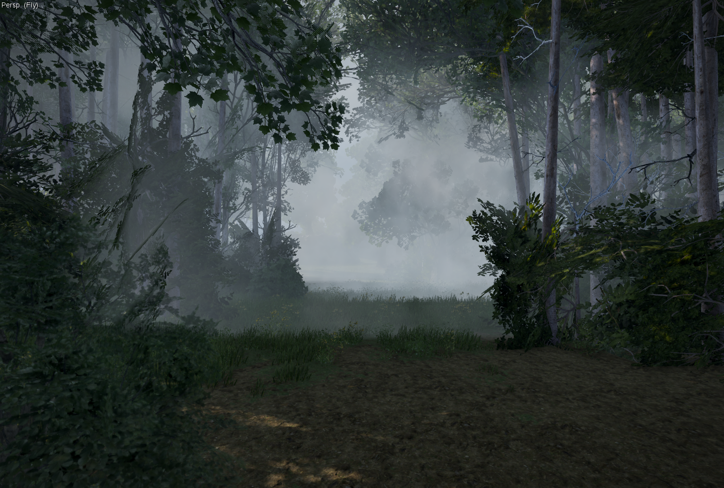
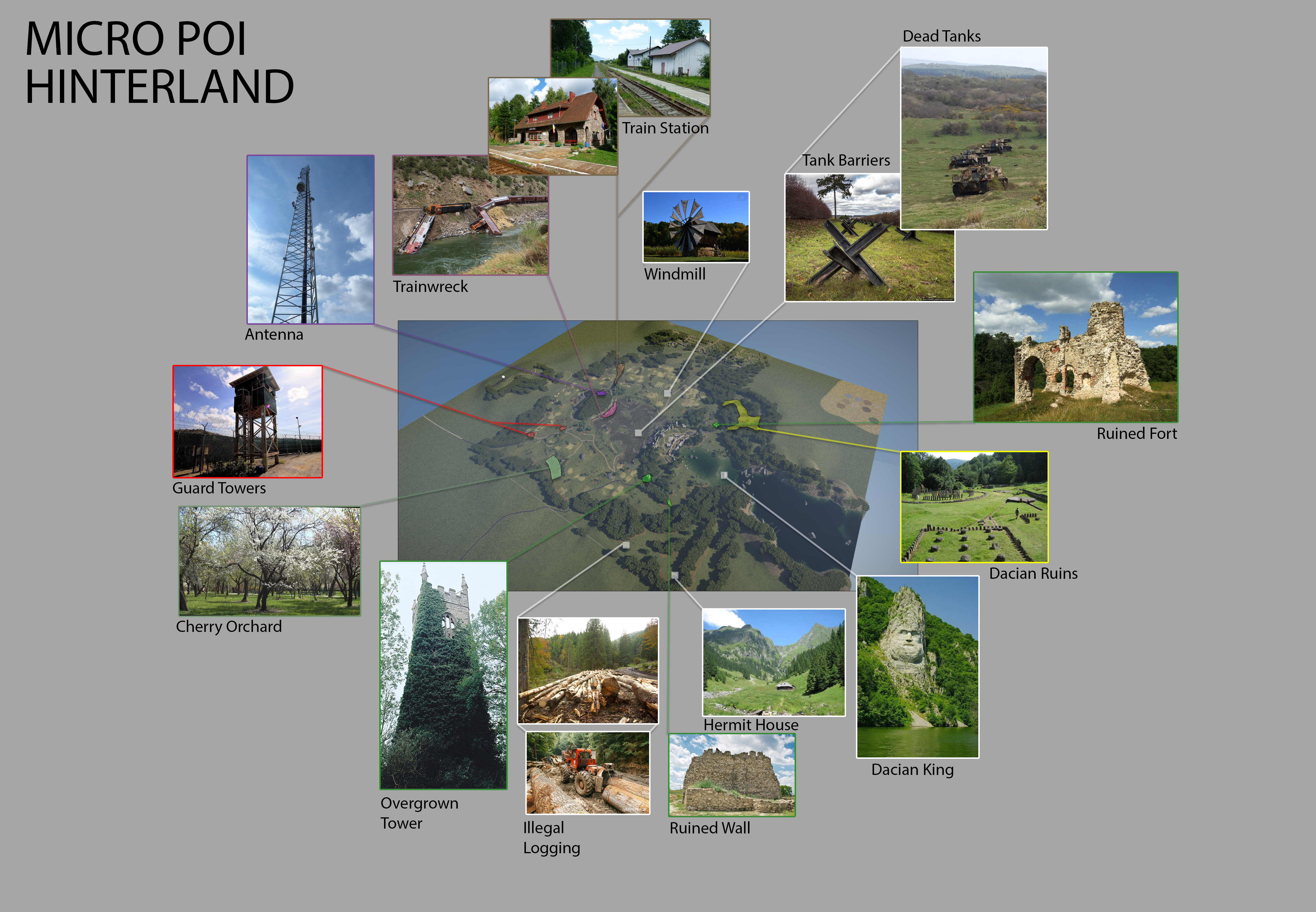
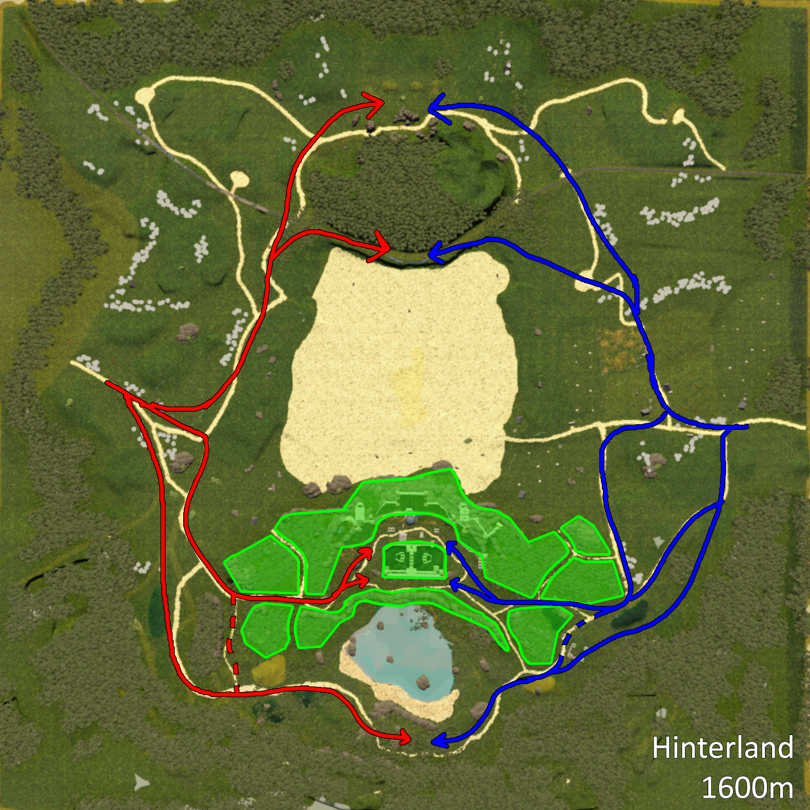
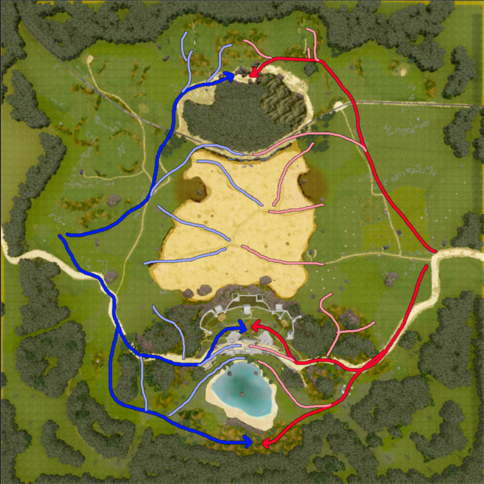
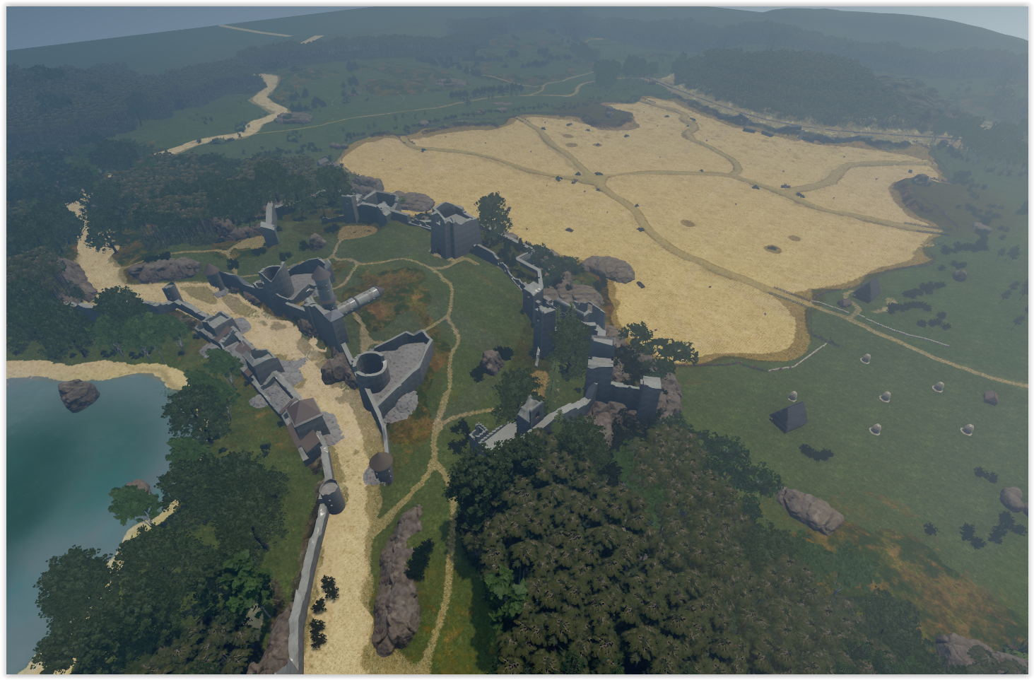
Hinterland
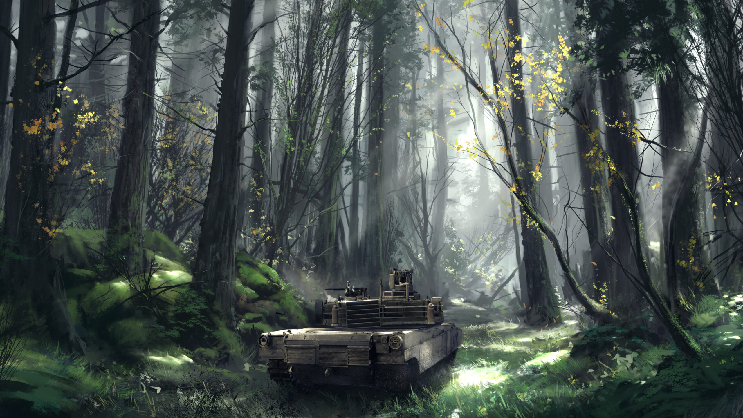
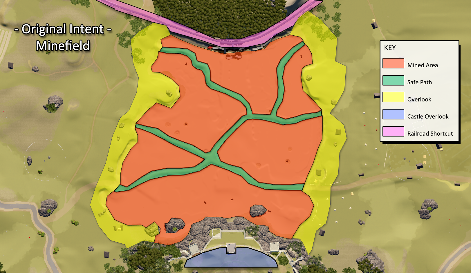
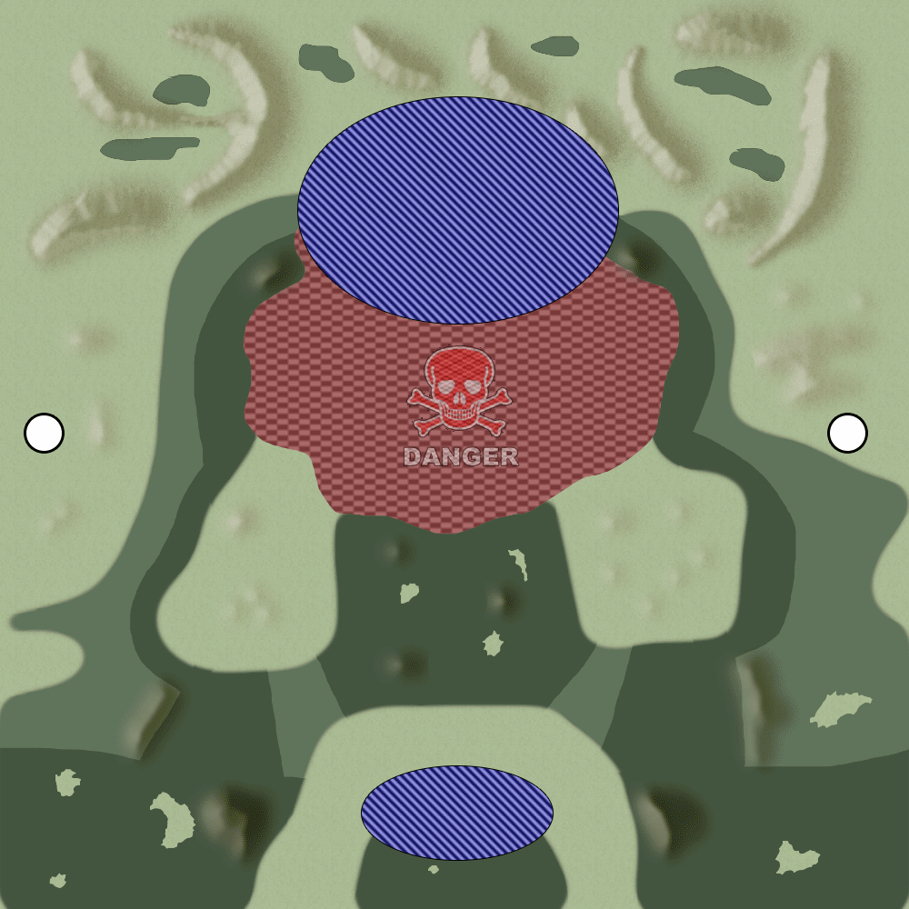
Takes place in Maramureș, Romania. New environmental features included fully dynamic Havok-based trees, forest barriers that act as translucent cover, and a Minefield mechanic that was prototyped, pitched, and optimized as a new game feature. Hinterland was selected for the launch line-up and was often cited as a team favorite.
- Design emphasis: constrained space, natural hazards, and strong positional play.
- Readability: long-range sightlines with intentional interruption via forests/barriers.
- System feature: Minefield mechanic (prototype → pitch → optimization).

Cerrado
Takes place in Brazil. Layout emphasizes low-lying cover, ditches, and field berms as constrained, tactical protection—rewarding precise positioning, rotation timing, and incremental control over sightlines.
- Design emphasis: limited cover density with deliberate “safe” contours and rotation trenches.
- Terrain language: berms and ditches as readable, repeatable tools for survival and counterplay.
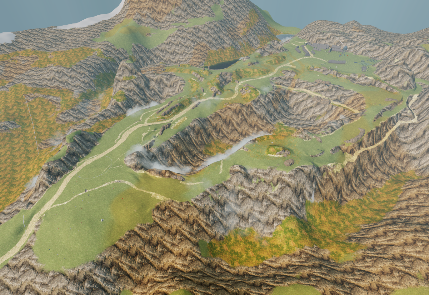
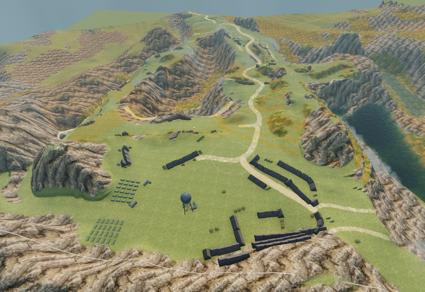
Olympus
Takes place in Greece. Layout emphasizes vertical combat with deep valleys and high peaks, enabling strong vertical play and distinct engagement layers depending on altitude and approach.
- Design emphasis: vertical combat grammar and readable height advantage/disadvantage states.
- Terrain language: valleys as safe approach corridors, peaks as commitment points and risk-reward platforms.
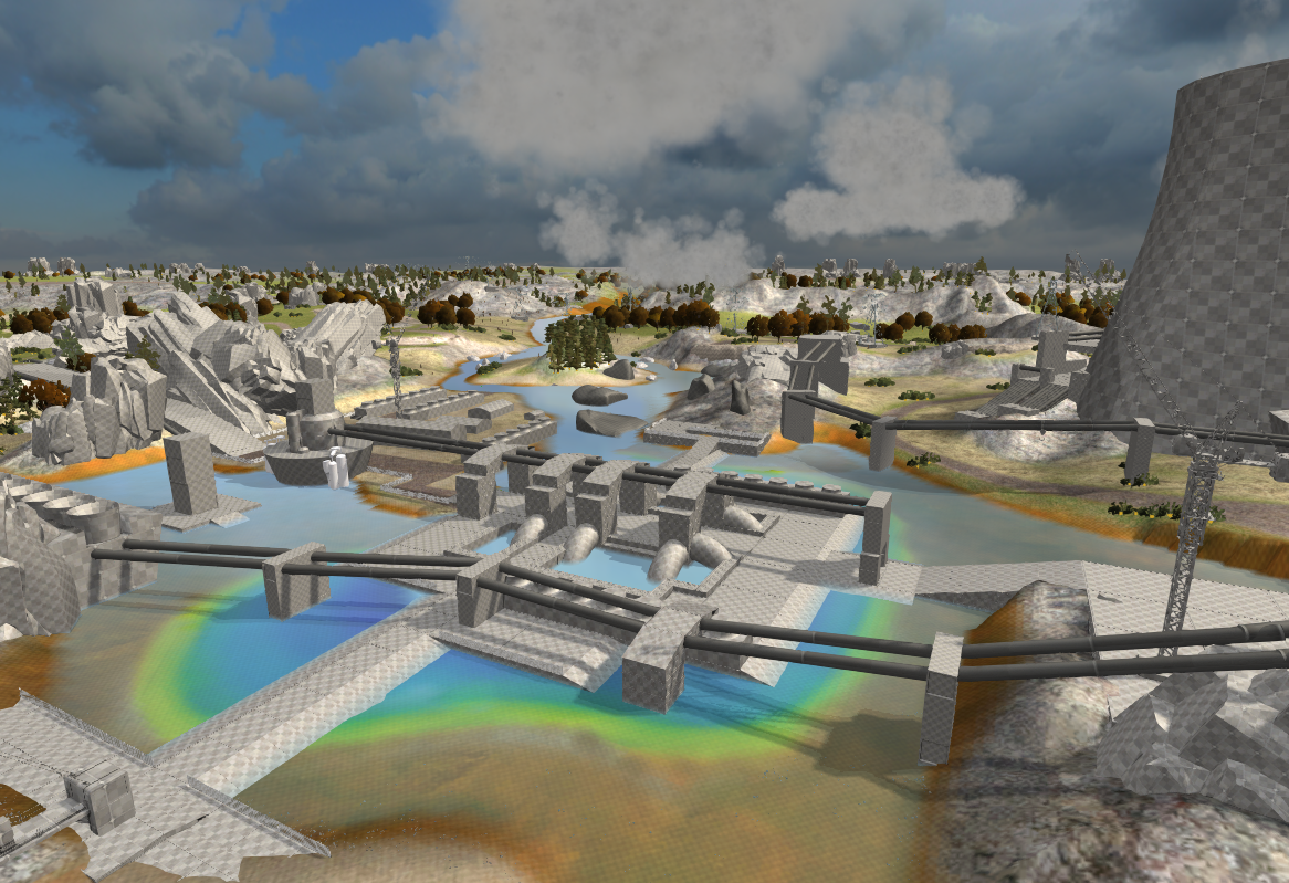
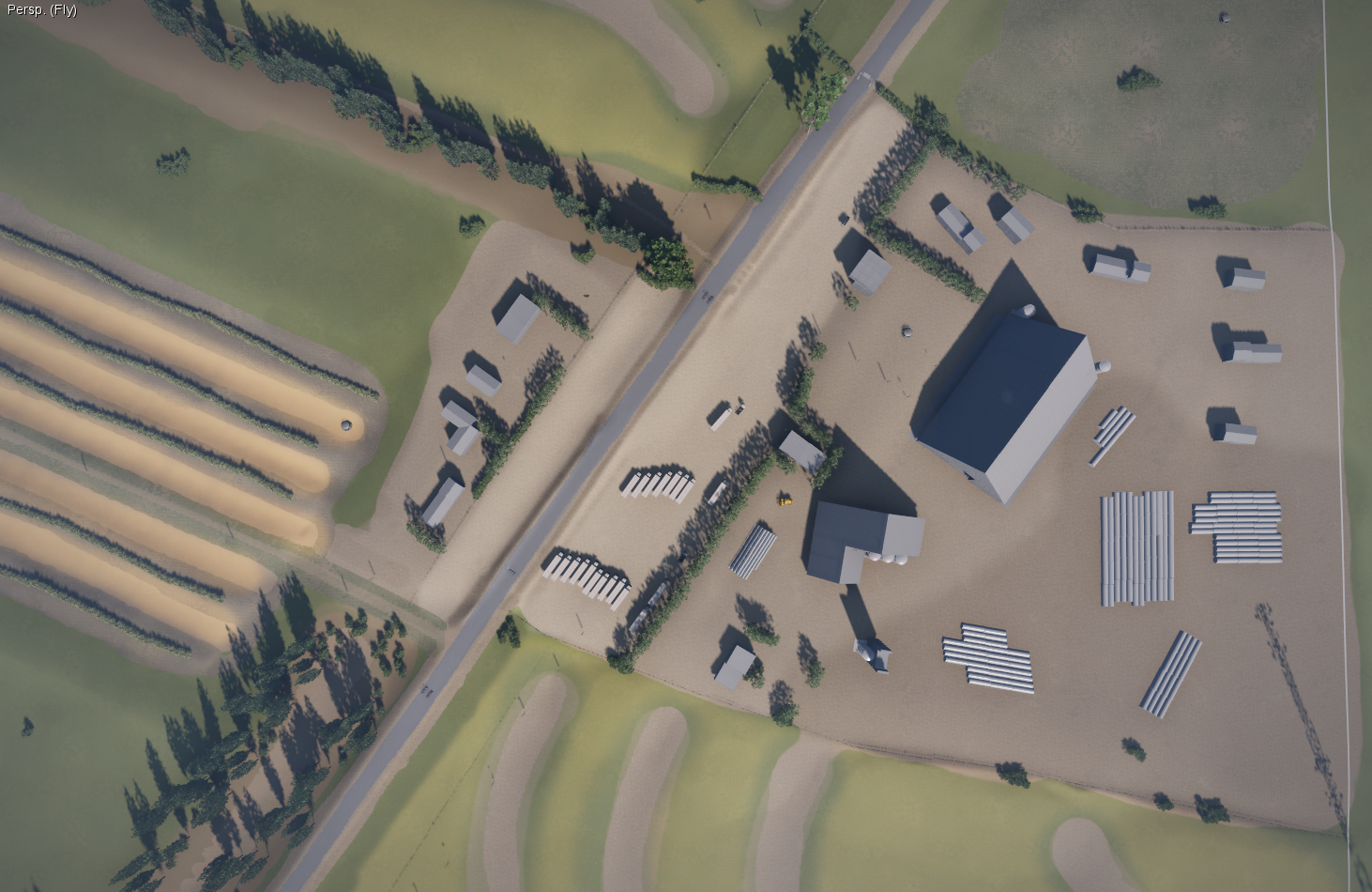
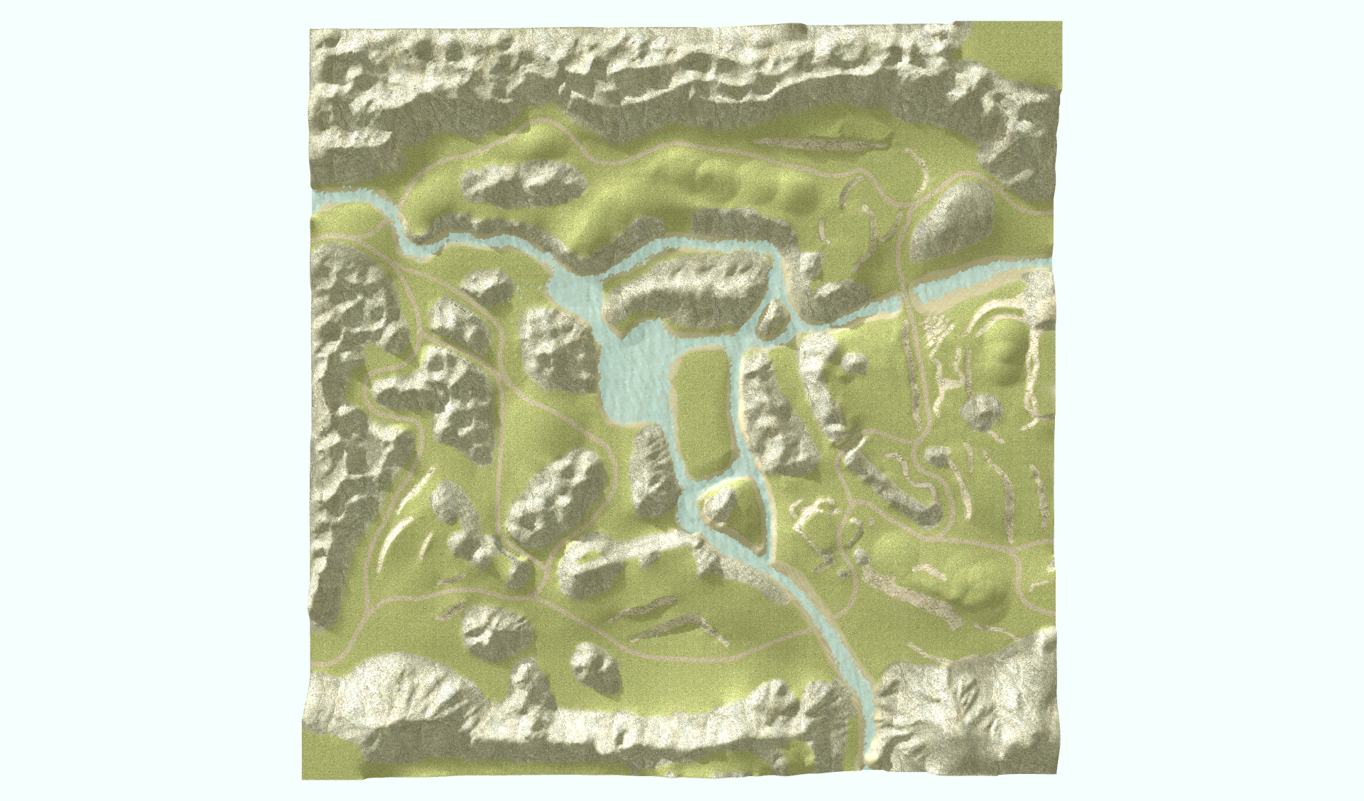
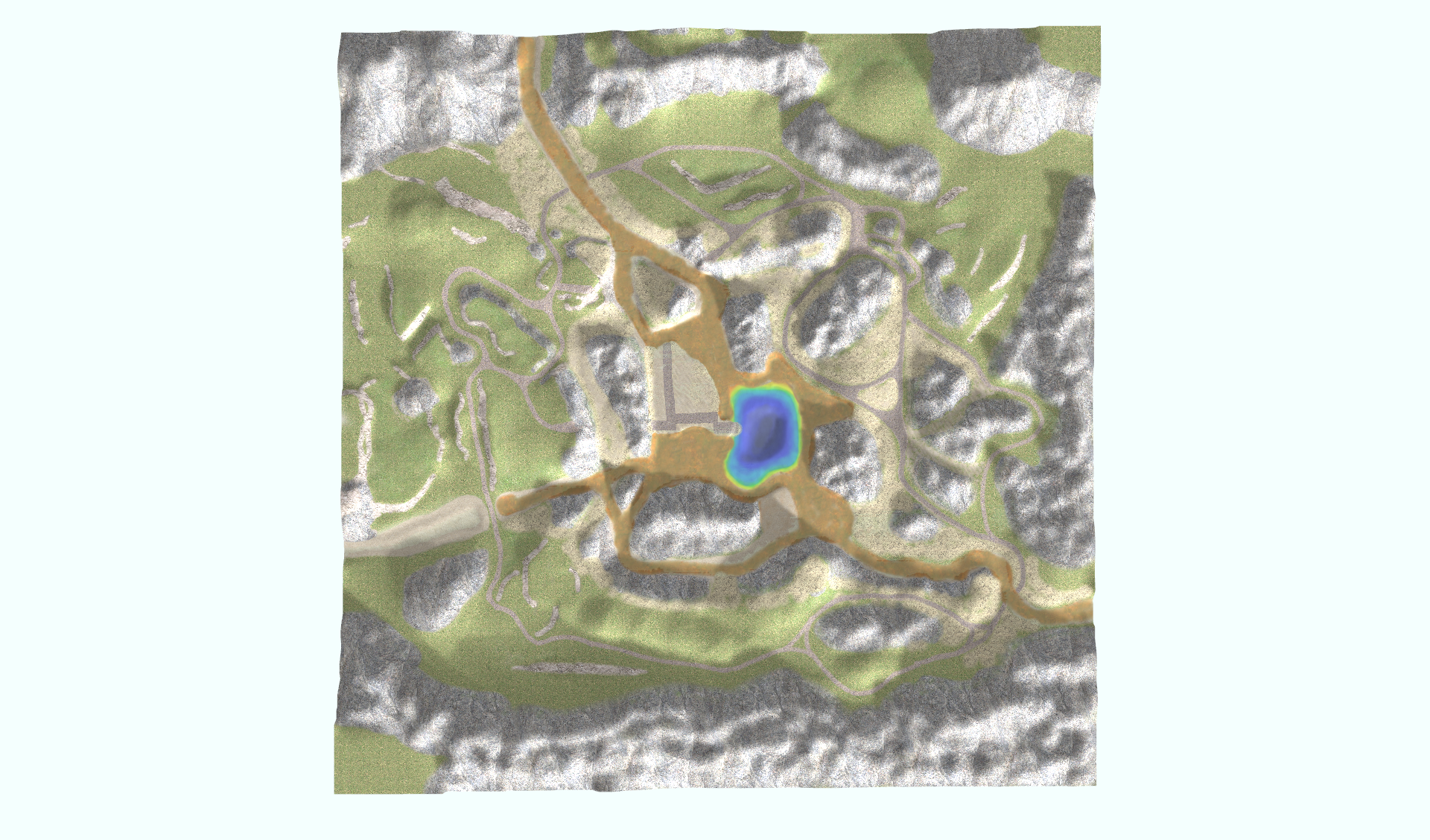
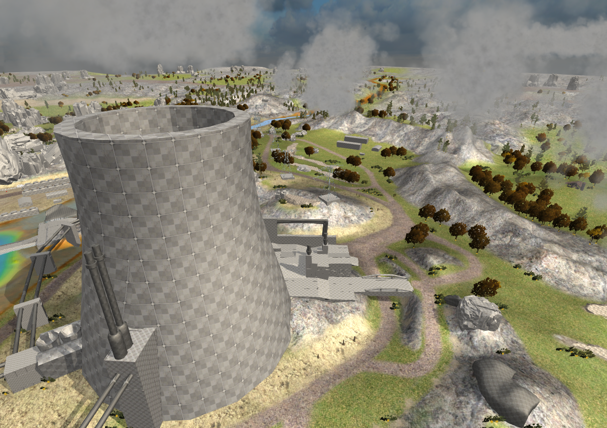
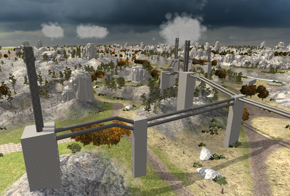
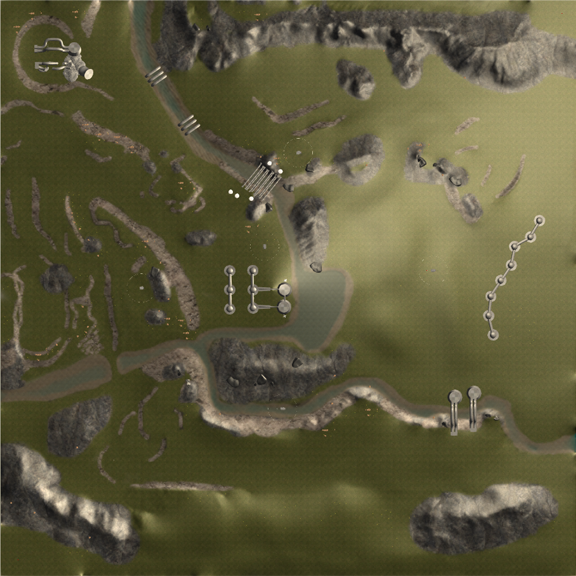
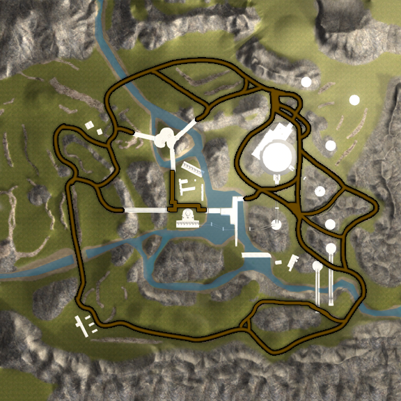
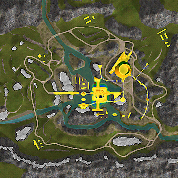
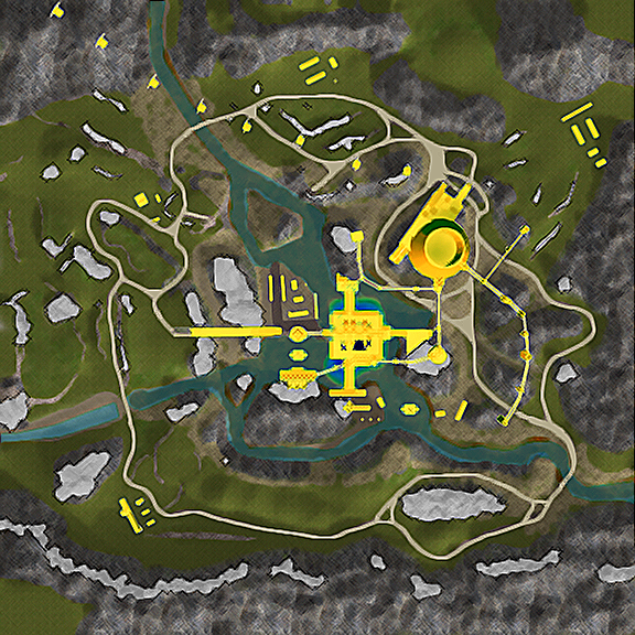
Yellowstone
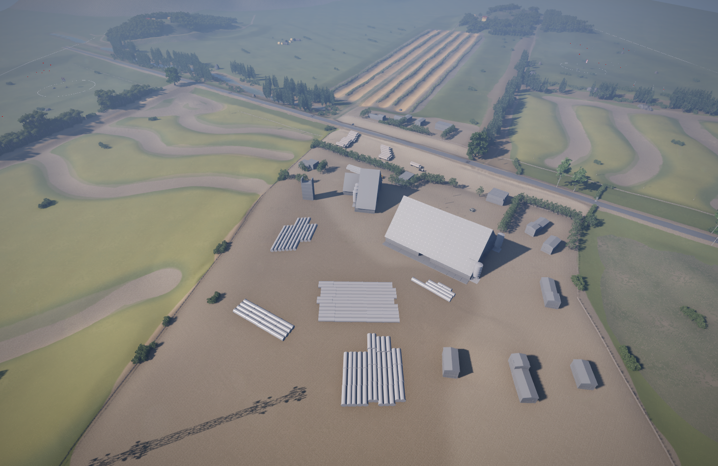
Takes place on a geothermal power plant along sulfur pools in Yellowstone National Park. Map design emphasizes a central, industrial base with complex corners and sightlines, surrounded by hills and dangerous sulfur pools.
- Design emphasis: dense central base for close-quarters angle play, with perimeter hills enabling range pressure and rotations.
- New hazard: sulfur pools that damage and eventually destroy the player when submerged.

- Multiplayer Map Design
- Terrain Heightmaps
- Physics-Driven Environments
- Playtest & Iteration